Uncrewed Aircraft Observations to Characterize the Land Surface and Its Interaction with the Lower Atmosphere

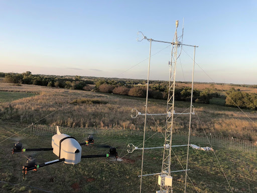
This project will utilize observations from uncrewed aerial systems (UAS) to gain a better understanding, as well as new perspectives, of weather and water over complex terrain. These observations, which include soil moisture, snow cover, snow reflectivity, vegetation, as well as lower atmospheric properties, will aid in development and advancement of weather and water forecasting…

Flooding: A Bird’s Eye View

By fusing high spatial resolution data from optical and Synthetic Aperture Radar (SAR) sensors obtained from both satellite and Unmanned Aerial Vehicles (UAVs) remote sensing, this project aims to develop an innovative methodology based on machine learning techniques for rapid delineation of flood boundary and water depth measurements. These measurements will provide floodplain topography data…

Evening of January 22 - snow coming down and not much car traffic. Image ID: wea04833, NOAA's National Weather Service (NWS) Collection Photo Date: 2016 January 22 Photographer: Courtesy of Joe Flood

Particle Imaging and Ceilometer Observations for Snowfall Properties and Blizzard Parameters

Accurate forecasting of blizzard occurrence, intensity, and extent is key to improving response to anticipated blizzard conditions. This project aims to use new particle imagers and laser ceilometers to measure and detect various snow properties to aid in improving blizzard and winter precipitation forecasting, as well as contribute to model verification, to reduce adverse outcomes…

High-impact observations for enhancing Great Lakes Snowfall forecasting

The Great Snow Forecasting Challenge of the Great Lakes

Through the deployment of affordable, automated, profiling, and high-temporal-resolution vertically pointing radars, snow particle imagers, and boundary layer sensors, this project will examine the characteristics of different snow regimes to demonstrate the utility of snow microphysical and ambient environmental characteristics observations in providing meaningful information for improved winter weather situational awareness and forecasting.

Look Up in the Sky! It’s a Bird! It’s a Plane! It’s a Weather Balloon!

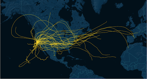
This project utilizes the innovative capabilities of WindBorne Systems’ Global Sounding Balloons (GSBs) to fill critical data gaps. To test this technology for operational use, multiple observation campaigns will be conducted, including over the Northern Pacific Ocean to collect data on atmospheric river formation and over the Atlantic Ocean to collect environmental data surrounding tropical…

The Multi-Radar Multi-Sensor (MRMS) Hydrometeorology Testbed - Hydro (hereafter denoted as HMT-Hydro) experiment is a part of the United States Weather Research Program (USWRP) through the Hydrometeorology Testbed (HMT) that runs from 24 June to 19 July 2019. During the HMT-Hydro experiment, forecasters and hydrologists from the National Weather Service (NWS) will work with National Severe Storms Laboratory (NSSL) research scientists to explore new technology and techniques to improve the prediction and warning of flash flooding. In particular, NWS participants will evaluate new probabilistic hydrologic modeling concepts and output within the Flooded Locations and Simulated Hydrographs (FLASH) system that could help convey the uncertainty of the flash flood threat. NWS participants will also evaluate high resolution precipitation forecasts from the NSSL Warn-on-Forecast (WoF) project and the addition of these forecasts into the FLASH system. Feedback from participants will allow NSSL research scientists to identify how these high spatio-temporal resolution precipitation forecasts could influence the warning decision making process, including the potential for increased warning lead time. Evaluations of the various probabilistic data sets will provide further understanding on the usability and effectiveness of these products, as well as guide future efforts of the Forecasting A Continuum of Environmental Threats (FACETs) project for flooding hazards. The HMT-Hydro experiment runs in conjunction with the Flash Flood and Intense Rainfall (FFaIR) experiment at the Weather Prediction Center (WPC) to collaborate on the short-term forecasting of flash flooding for both a national and regional scale.

Improving Quality Control of Multi-Radar Multi-Sensor Products

With a focus on upgrading the quality control algorithm for the Multi-Radar Multi-Sensor (MRMS) system, this project aims to allow the MRMS system to more effectively identify and filter non-meteorological artifacts from the radar data. This will eliminate these non-meteorological artifacts from transferring into final radar data products that serve operational end users across aviation,…

NEXRAD Radar

Decluttering the Sea Clutter

This project will develop a non-hydrometeor subclass for classifying sea clutter, i.e. unwanted radar returns from ocean waves, within the HCA. The ability to classify and remove sea clutter will enable Air Traffic Control safer decision making, improve radar data assimilated into forecast models, and assist NWS forecasters in more confidence discerning coastal weather in…